
What area is included in Callander’s Place Plan?
Introduction
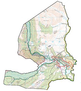
Maps play an important role in developing any Place Plan. The legislation governing the Place Plans is clear that any community proposals must be clearly indicated on a map.
This one shows you all the land that we will be considering in Callander’s Place Plan. It represents the area falling within our Community Council’s boundary rather than the physical boundary of the town.
Callander’s Zones
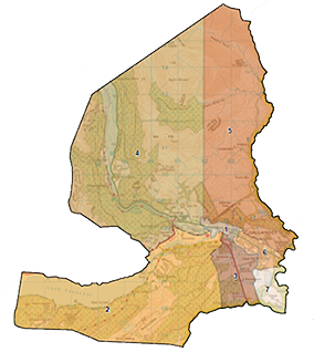
To make it easier to focus on specific proposals, we have divided the town into 7 zones. These are not the same zones used in the past consultations, instead we have used development potential as a rationale. Zones 1 and 6, for example run from the town boundaries (along the A84) on the north bank of the river while zones 3 and 7 mirror areas identified by the Park for new housing, visitor attractions and light industrial use.
Zones 2,4 and 5 are not considered suitable for new development (by the Park) but can be used to increase connectivity via pedestrian and cycle paths or let us think about visitor management proposals.
When we start the bigger public consultation exercises, we will refer to proposals, and allocate your suggestions to each zone.


